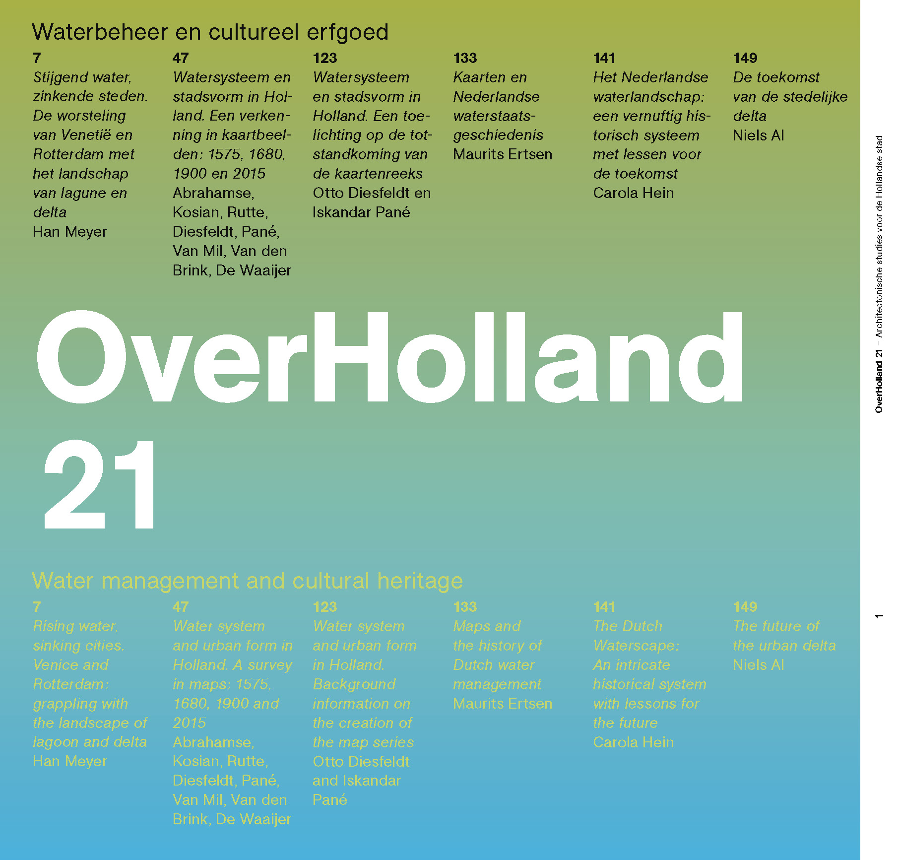
OverHolland is published by KNOB (Royal Netherlands Society of Architectural History) on behalf of Delft University of Technology, Faculty of Architecture.
Editors
Henk Engel, Esther Gramsbergen, Reinout Rutte, Judith Fraune, Otto Diesfeldt, Iskandar Pané
ISBN
9789463663991
Published:
2021-07-01
Preface
-
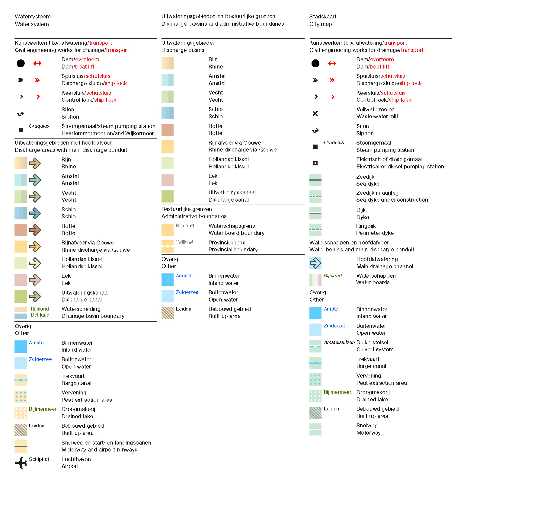
Legend to the article Water system and urban form in Holland. A survey in maps: 1575, 1680, 1900 and 2015
Editorial
-
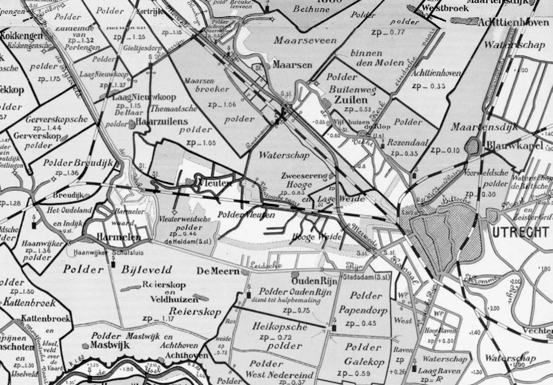
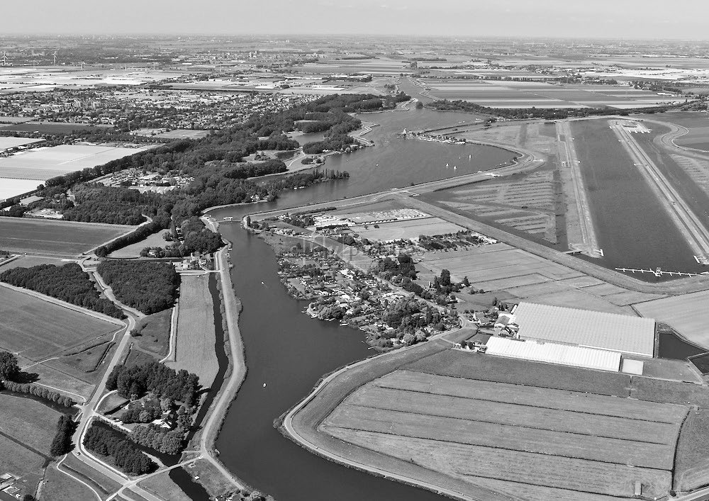
This edition of OverHolland turns the spotlight on the water management system in a part of the Netherlands known as Randstad Holland, namely the area between the Maas and IJ rivers, the North Sea coastal dunes and the Utrechtse Heuvelrug. This study was prompted by a unique, four-sheet map, on a scale of 1:50,000, published in 1901: the Polderkaart van de landen tusschen Maas and IJ (Polder map of the lands between Maas and IJ), made by Willem Hendricus Hoekwater (1865- 1956), a teacher in Amsterdam. It was the first comprehensive overview of the water system in this...
Articles
-
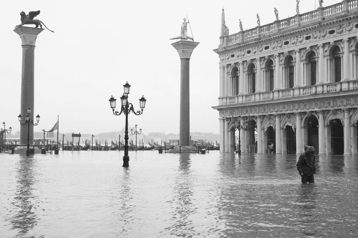
Since the turn of the century, high water levels in cities in coastal and delta areas have given rise to ever-increasing problems. It is not just the many cities in the ‘Global South’, burdened with inadequate defences against high water levels, that are having to contend with increased flooding. Even relatively wealthy cities in Europe and the United States, the damage wreaked by Hurricane Katrina in New Orleans (2005) and by Hurricane Sandy in New York (2013) still fresh in their minds, have good reason to be concerned. In Europe, as recently as November 2019, the Grande Dame of water...
-
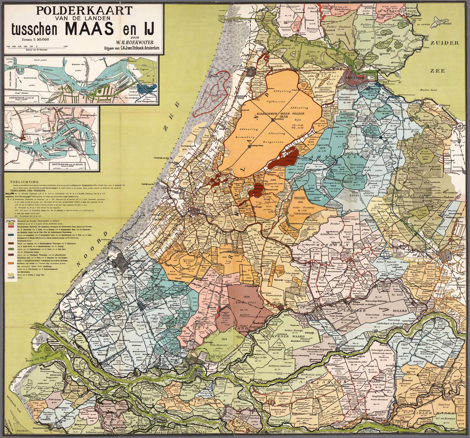
In 1901, the Polderkaart van de landen tusschen Maas en IJ (Polder map of the lands between Maas and IJ) appeared in print. This large coloured wall map was the work of W.H.Hoekwater of Charlois, a teacher by profession.The map had an educational purpose: Hoekwater wanted to show just what a ‘singular country’ this low-lying area of the Netherlands was, built and maintained through the ‘sheer willpower and genius of earlier and current inhabitants’. His explanatory notes consist of a brief technical introduction and, most notably, a summary and description of the storage...
-
We regard a cartographic image as scientific output provided it is accompanied by a theoretical underpinning and explanatory notes. The study ‘Water system and urban form in Holland. A survey in maps: 1575, 1680, 1900 and 2015’ brings together the overlapping and complementary methodologies and expertise of the Rijksdienst voor het Cultureel Erfgoed (RCE – Cultural Heritage Agency) and the Faculty of Architecture at Delft University of Technology (TUD). Both institutions have considerable experience with the use of maps, in terms both of the research itself and in documenting the results...
-
The detailed account of discussions between the Waterlanders, the reeve and Amsterdam provided by the 2019 book Broek en Waterland. Regionale samenwerking en conflicten, 1281-1811, makes it clear that Broek in Waterland and fellow villages were continually engaged in realising influence and achieving aims through negotiation. The book also shows that the material environment that was the consequence of negotiation in turn exerted considerable influence on those negotiations. The influence of the human participants was realised by non-human actors such as money, wood or...
-
‘You cannot step into the same river twice, for fresh waters are ever flowing in upon you’ is a saying attributed to the Greek philosopher Heraclitus. And like Heraclitus, any study of water systems must acknowledge constant flow as an essential property. Studying the Netherlands from the perspective of water, therefore, means taking constant flow into account. In fact, the polder land of the Netherlands depends on dykes and dams that
facilitate the flow of natural rivers and artificial canals. Maps generally show water as a blue line, which appears static, but in fact it is... -
W.H. Hoekwater’s Polderkaart van de landen tusschen Maas en IJ (Polder map of the lands between Maas and IJ) (p. 46) is a compelling illustrationof just how complex and artificial the watersystem in this part of the Netherlands was around 1900. It was the outcome of centuries of human interventions in the delta aimed at improving drainage, increasing flood protection and facilitating growing economic prosperity. One the defining features of deltas is their dynamic nature: changes in the ‘natural’ system and in society prompt continuous adjustments to the water system....
-
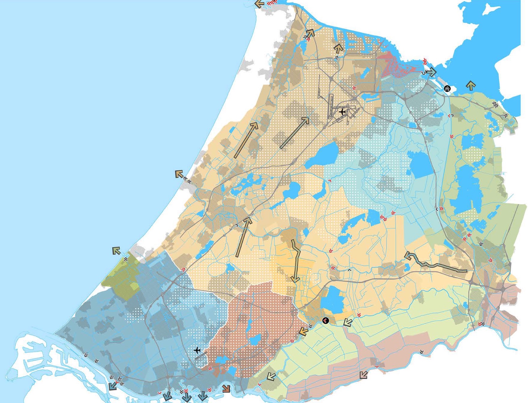
The Dutch landscape is about to be reconfigured yet again. This time not in order to make the delta inhabitable through reclamation or to organise it more efficiently for agriculture through land consolidation but, in this age of climate change and population growth, to make the land more resilient and liveable for human beings, flora and fauna. Owing to sea level rise, an increase in torrential rainfall events, summer droughts, progressive soil subsidence and saline seepage, water-related problems are on the rise.
Fundamental to the organisation of the lowlying western part of the...
Polemen
-
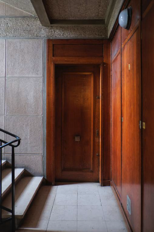
I recall a photo of an entrance portico during construction. Soberly black-and-white. The limpid Le Havre light streams through the facade openings. The hall behind is filled with workmen enveloped in clouds of Gitanes and dust, busily bush hammering the top layer of the cast-in-situ concrete on walls and ceiling. It is one of the entrance porticos in the ensemble of buildings that line the south side of Place de l’Hotel de Ville, designed immediately after the war by the architect Auguste Perret. If you enter the building via one of these entrances today and walk into the adjacent...
-
Book reviews of
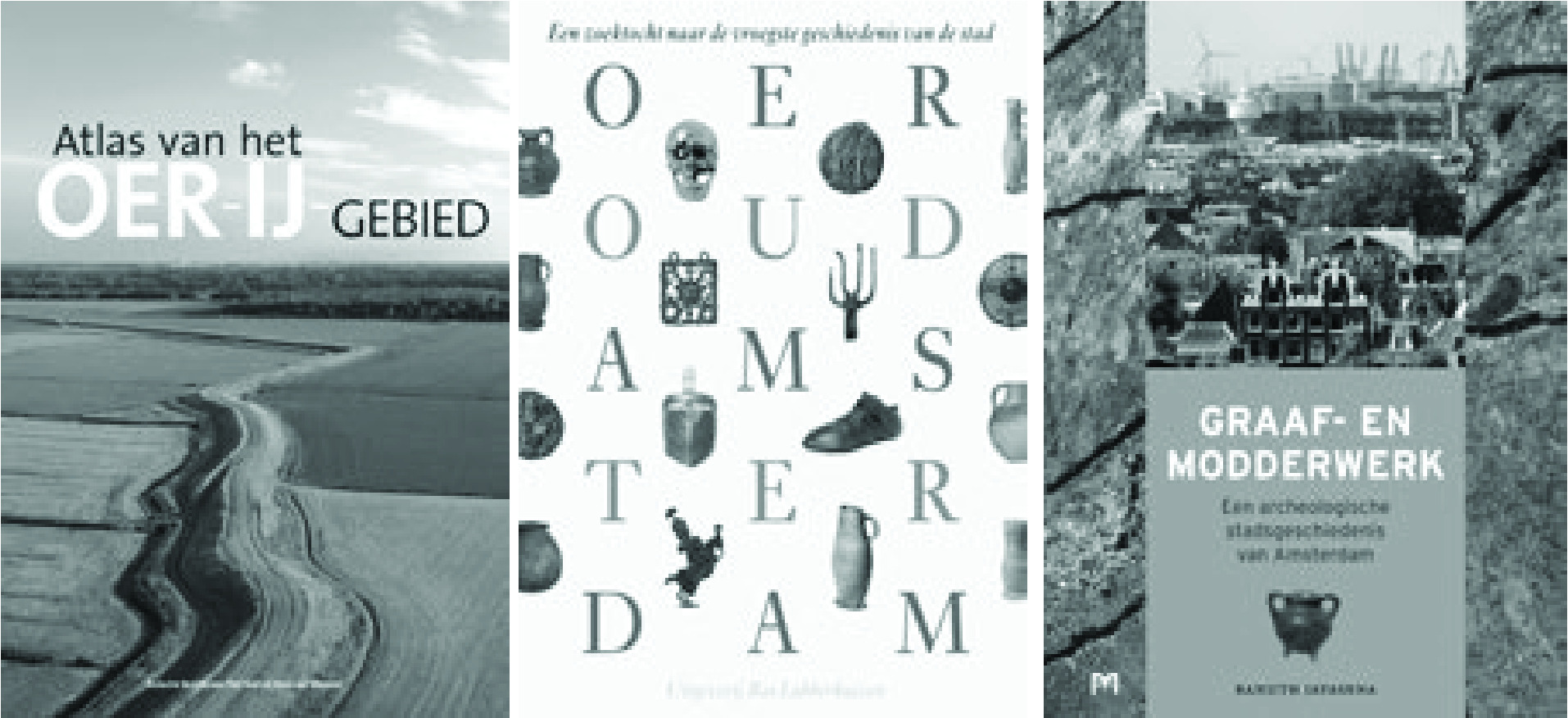
Bert Buizer, Piet Veel en Hans van Weenen (eds.), Atlas van het Oer-IJ-gebied
Jan Boomgaard, Clé Lesger en Kees Zandvliet (eds.), Honderdnegende Jaarboek van het Genootschap Amstelodamum. Oeroud Amsterdam. Een zoektocht naar de vroegste geschiedenis van de stad
Ranjith M. Jayasena, Graaf- en modderwerk. Een archeologische stadsgeschiedenis van Amsterdam
-
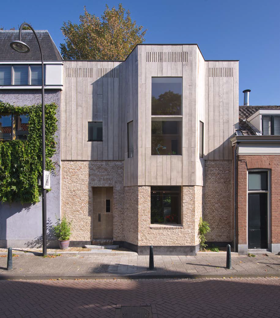
The city gate is long gone but anyone entering the centre of Dordrecht via the Sint Jorisbrug will still be conscious of crossing a boundary. Rather than the bridge spanning the Spuihaven, which is pretty inconspicuous, it is greenery along the water that makes this a recognisable transition point. On the left-hand side the eye is caught by a group of majestic trees standing in the deep gardens of the houses lining the Vest. One of those houses, Vest 84, was recently rebuilt from the ground up. The project was both designed and built by Ber Mooren.
The house is not big. With a...
