Downloads
DOI:
https://doi.org/10.7480/overholland.2013.12/13.1701Abstract
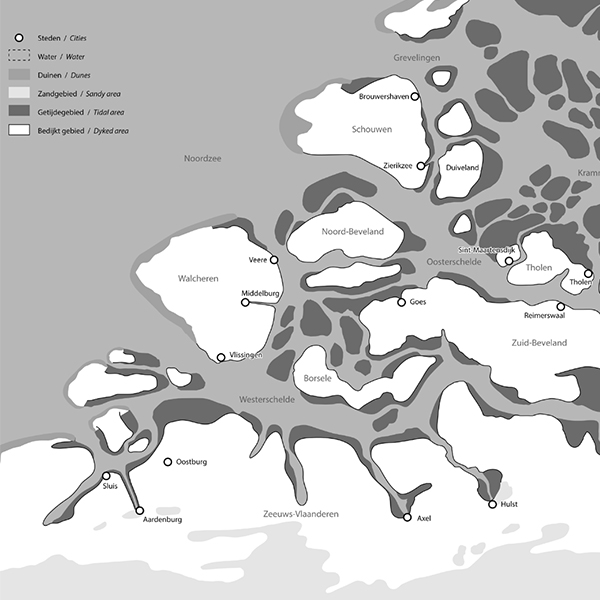
The Dutch province of Zeeland has an unusually large number of large and small towns, including Zierikzee, Brouwershaven, Veere, Middelburg, Vlissingen (formerly known in English as Flushing), Goes, Tholen, Hulst, Axel, Oostburg, Sluis and Aardenburg. These developed over a period of some four hundred years, from the eleventh to fourteenth centuries. Since most of these towns declined economically at the end of the Middle Ages, some are fairly well preserved, while others are now just modest local centres. It takes some imagination to realise that what is now often considered a peripheral, largely agricultural province was once one of the most urbanised parts of the Northern Netherlands. How did so many towns develop there, and what kind of towns were they?
How to Cite
Published
Issue
Section
License
Copyright (c) 2013 OverHolland

This work is licensed under a Creative Commons Attribution 4.0 International License.
